
5-day self-guided Central Highlands itinerary: Buon Ma Thuot – Pleiku – Kon Tum
PrintSplit five days in the Central Highlands into two around Buon Ma Thuot, a journey to Pleiku and time in Kon Tum before returning to the airport. National Highway 14 links the main legs, but leave space for breaks and roadside stops. Flying into Buon Ma Thuot and out of Pleiku saves a return journey to your starting point.
Coordinate diagram, not a route map. Open the map to check the access road.
| Day | Journey | Distance |
|---|---|---|
| Day 1 | Getting to know Buon Ma Thuot | — |
| Day 2 | Waterfall and elephant watching | — |
| Day 3 | Buon Ma Thuot to Pleiku | — |
| Day 4 | Pleiku up to Kon Tum | Check the actual route |
| Day 5 | Kon Tum back to Pleiku | — |
 01
01
 01
01
 02
02
 01
01
 01
01
 01
01
- Dry seasonPleasant roads, safer for self-driving
- Rainy seasonNH14 is slippery, visibility is reduced, with mud and potholes
reference price; children under 1m2 free
reference price, depending on ticket type
reference price
reference price
Agree the total price, pickup time and extras
- Check the ticket prices and opening hours of the World Coffee Museum close to your travel date
- Check the Kon Tum – Mang Den route if extending your trip
- Ask about the deposit fee and fuel when picking up the motorbike
Itinerary overview
The basic travel flow runs from south to north along National Highway 14: the first two days around Buon Ma Thuot and the waterfalls, day three heading up to Pleiku, day four through Kon Tum, and day five back to Pleiku. If you fly into Buon Ma Thuot and fly out of Pleiku, you travel one way without doubling back, which fits this point-to-point route very well.
Route map and 5-day travel flow
Buon Ma Thuot – Pleiku via National Highway 14 is around 177–212 km, depending on the starting point, destination and route. Allow roughly 3.5–4.5 hours of travel, plus breaks. Check your actual journey before fixing an arrival time rather than treating the distance between two cities as a precise riding schedule.
Pleiku – Kon Tum is the shorter leg: allow around an hour of travel, followed by sightseeing. Check the route from your accommodation to the places you plan to visit; coordinate distance is not the same as driving distance.
NoteFrom July 1, 2025, Kon Tum province was merged into Quang Ngai province, under the shared name Quang Ngai. Pleiku still belongs to Gia Lai province and Buon Ma Thuot still belongs to Dak Lak province after the reorganization. The names of tourist destinations have not changed, but if you need to look up administrative procedures, you should recheck the current name of the commune/ward unit.
Best time to go and characteristic seasons
The rainy season makes the surface of National Highway 14 slippery and reduces visibility, and some sections develop mud or potholes. For a long-distance route like this, the dry season is far more comfortable and safer, especially if you're driving yourself.
Day-by-day details
Each day below groups the sites by geographic cluster to minimize backtracking.
Day 1 – Buon Ma Thuot
Keep the first day light, wandering around the city to get used to the rhythm and build up energy for the driving days ahead.
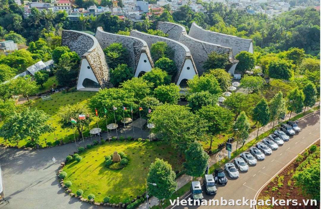
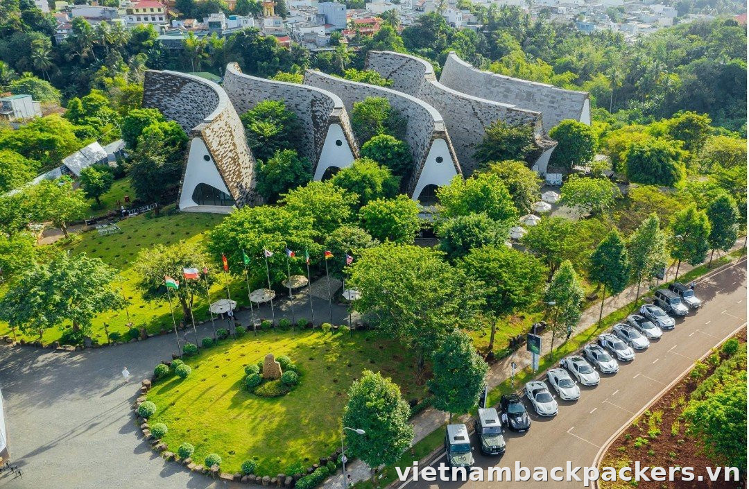
The World Coffee Museum
The World Coffee Museum opened on November 24, 2018, built by the Trung Nguyen Legend Group, set within a 45-hectare complex with display and exhibition areas and coffee-tasting spaces. This is a good spot for first-time visitors to Buon Ma Thuot who want to understand the story of coffee, so set aside about half a day.
The museum offers different ticket types and experience packages. Decide what you want to see, then check the price, opening hours and inclusions for your visit. Do not budget from a single admission figure for every package.
Day 2 – Dray Nur Waterfall and Buon Don
This is a nature day, combining the waterfall cluster with an elephant-observation session. Both directions start from Buon Ma Thuot, so pick one focus for the afternoon.
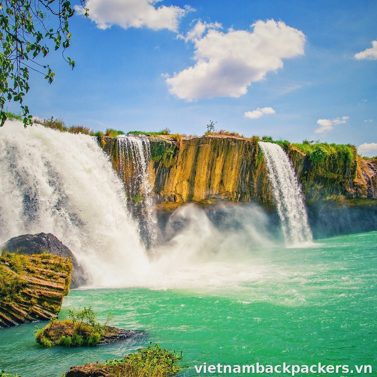
The Dray Nur – Dray Sap – Gia Long cluster
Dray Nur Waterfall is about 20–25 km from central Buon Ma Thuot along National Highway 14, roughly 45 minutes by car. Admission to the waterfall is commonly 30,000đ/adult, children over 1m2 also 30,000đ, under 1m2 free; the ticket usually comes with a cup of coffee (reference prices).
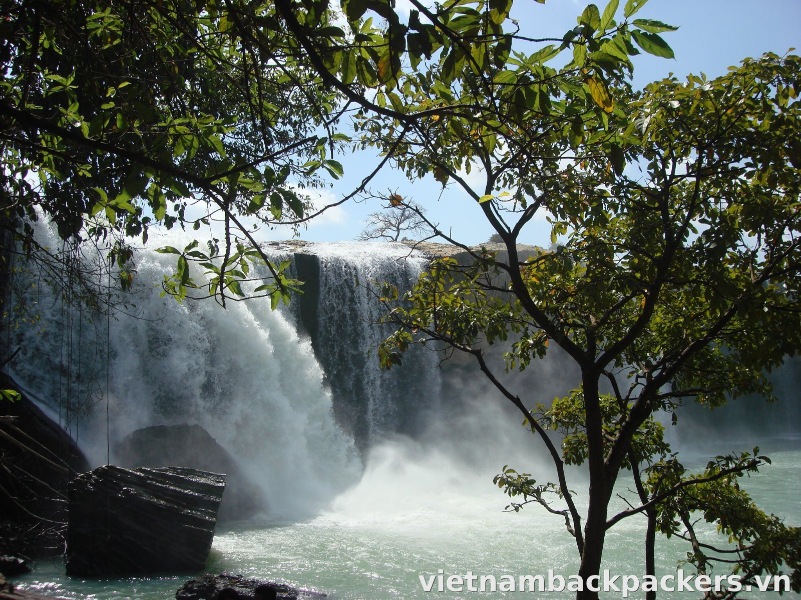
From Dray Nur you can link over to the Dray Sap – Gia Long cluster on the Dak Nong side. Tickets for this cluster are about 40,000đ/adult, while the Gia Long ticket alone can go up to 80,000đ if you approach from the Dray Nur direction (reference prices). Prices are not consistent depending on direction, so ask clearly at the counter before buying.
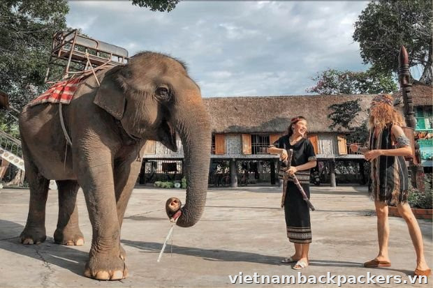
Buon Don – observing elephants only
Buon Don Suspension Bridge Tourism Center officially discontinued elephant riding entirely from February 10, 2023, switching to an elephant-friendly tourism model. Instead of riding, visitors observe elephants in a semi-natural environment, feed them, bathe them and splash water with them under the guidance of mahouts. If you want a responsible experience, this is the option to prioritize.
Day 3 – Buon Ma Thuot to Pleiku
This is the longest driving day. You should set off early in the morning because the Buon Ma Thuot – Pleiku leg takes 3.5–4.5 hours depending on the route, leaving time to rest and stroll around Pleiku on arrival. Since National Highway 14 was upgraded, this leg is much easier than before.
Day 4 – Pleiku up to Kon Tum
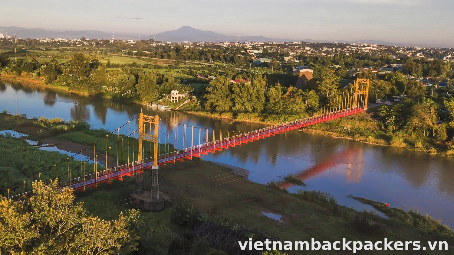
Spend day four in Kon Tum and the villages along the Dak Bla River. From Pleiku, allow around an hour for the main leg, plus travel to individual stops. Choose a manageable group of places so you have time to walk and rest rather than rushing through many stops.
Kon K'Tu ancient village
At Kon K'Tu village by the Dak Bla River, leave time for a walk and a respectful look at village life. If you want dinner, an overnight stay or a dugout-canoe trip, ask the local organiser about available services and prices before planning around them.
Day 5 – Kon Tum back to Pleiku
Return to Pleiku on the last day according to your flight time. Add a nearby stop in Kon Tum only if you still have time for the drive, vehicle return and airport formalities. For Mang Den, set aside extra time rather than squeezing it into the morning before a flight.
Getting between the sites
The advantage of this route is that the inter-provincial legs all lie on National Highway 14 and aren't too long. Below are the figures to help you time things accurately.
Inter-provincial legs along National Highway 14
Buon Ma Thuot – Pleiku is around 177–212 km depending on the route and endpoints. Allow roughly 3.5–4.5 hours of travel, plus breaks. For Pleiku – Kon Tum, allow around an hour and check the route from your accommodation before fixing the schedule.
Pleiku Airport – central Kon Tum is around 38–45 km: roughly 45 minutes to 1 hour 15 minutes by taxi or limousine, or 60–80 minutes by motorbike. Confirm the route, pickup time and journey duration with your provider, especially when connecting to a flight.
If adding Mang Den, check the National Highway 24 route from your accommodation to your intended stop. Include the return journey and breaks, then add time or remove another group of stops from the itinerary.
Getting around within the area each day
For the waterfall day, Buon Ma Thuot – Dray Nur is around 25 km; allow about 45 minutes of travel. On National Highway 14, follow the speed signs for each section and slow down in residential areas or reduced visibility.
Costs for this itinerary
Most of this route's cost goes to airfare (if flying), vehicle rental and lodging. The admission and rental figures below are all reference prices and fluctuate over time.
Admission tickets and services
Dray Nur has a reference adult admission price of 30,000đ; confirm the price and inclusions when buying. For the World Coffee Museum, choose a package and get the price for your visit. Basic admission and experience packages should not be treated as one cost.
Vehicle rental and airport transfer costs
Motorbike rental in Buon Ma Thuot is commonly about 100,000–150,000đ/day for a manual bike and 150,000–200,000đ/day for a scooter, charged on a 24-hour cycle (reference prices). Remember to ask about the deposit and fuel when picking up the bike.
For Pleiku Airport – Kon Tum, arrange transport and agree the price for your group, luggage and pickup time. Ask for the total trip cost, waiting charges and any surcharges. If considering a bus, confirm the route, pickup point and timetable before planning around it.
Reference total cost table for the whole route
The table below does not include airfare, meals and incidentals; all are reference prices.
| Item | Reference level | Notes |
|---|---|---|
| Dray Nur Waterfall ticket | 30,000đ/adult | |
| World Coffee Museum ticket | Confirm the package price for your visit | |
| Manual/scooter motorbike rental | 100,000–200,000đ/day | |
| Pleiku Airport – Kon Tum (bus) | Confirm the route, timetable and fare | |
| Pleiku Airport – Kon Tum (private transfer) | Get a quotation for the whole trip |
Notes
National Highway 14 is generally easy to drive, but there are still sections requiring caution, and visiting villages calls for proper etiquette.
Safety on National Highway 14
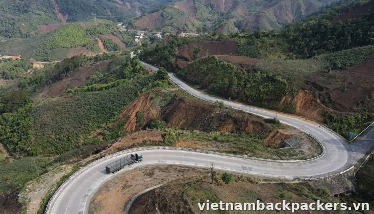
The Buon Ma Thuot – Pleiku stretch has few mountain passes and slopes and is easy to drive, but truck and container traffic is quite heavy at peak hours, so groups usually set off during the day for safety. Many sections have solid lines, and heavy trucks climbing slowly cause long lines of vehicles behind, so avoid reckless overtaking on blind curves.
If extending beyond Buon Ma Thuot – Pleiku – Kon Tum, check roads and the forecast for the additional route. Do not assume every section of National Highway 14 has the same conditions. In rain, slow down and allow more time.
NotePrioritize driving in daylight on National Highway 14, avoid overtaking on blind curves when stuck behind a truck, and slow right down when it rains.
How to behave when visiting villages and communal houses (nha rong)
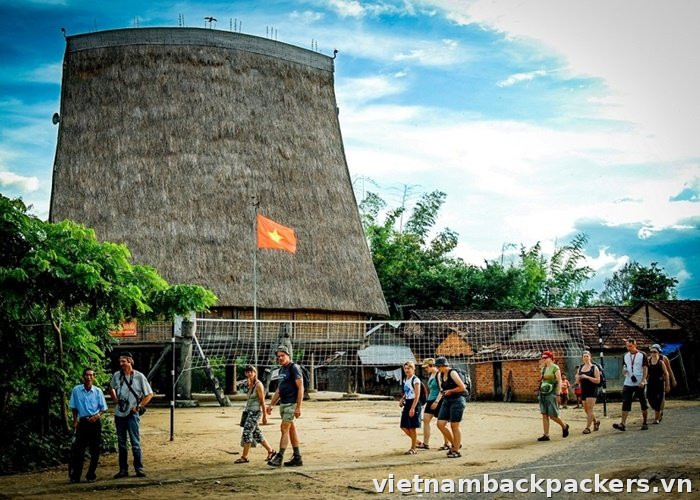
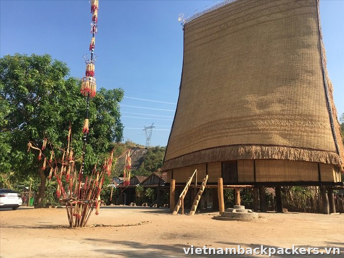
The rong communal house is part of village life, with customs that differ from place to place. Ask the person responsible where visitors may go, whether to remove footwear and where photography is allowed. Follow local guidance rather than applying one rule to every village.
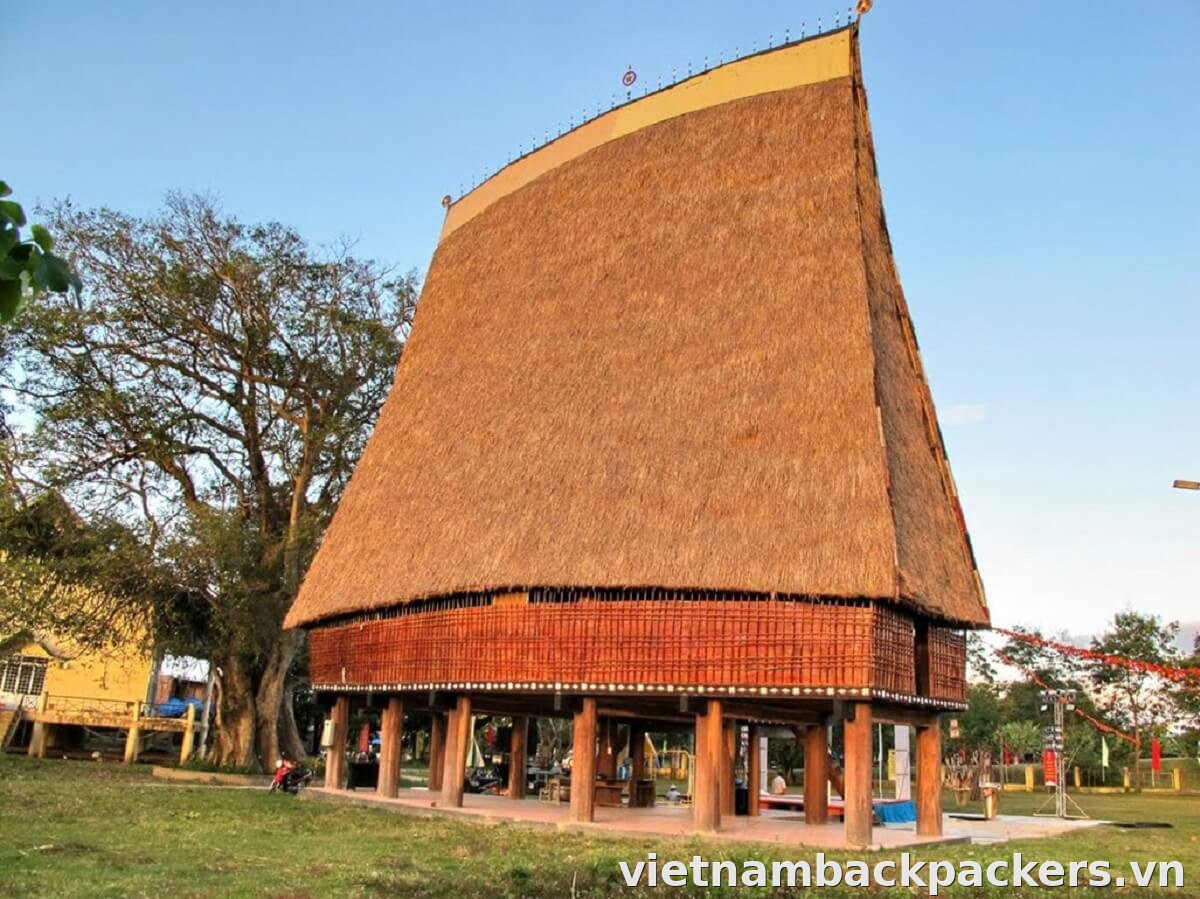
If you want to learn about village life, ask a local organiser or host to guide you first. Get permission before entering homes, taking photographs or starting a conversation. If residents are busy or do not want visitors, give them space and choose another time.
Observe elephants responsibly, do not ride elephants
The Buon Don Suspension Bridge Tourism Center stopped elephant rides on 10/2/2023. Prioritise watching from an appropriate distance and follow the carers' instructions. Ask what the current programme includes; do not assume feeding or bathing is always offered or appropriate.
Check before you go
- Ticket prices and opening hours of the World Coffee Museum, as these change a lot depending on the ticket type.
- The route and travel time to Mang Den if extending your trip.
- The forecast and road conditions for your chosen route.
- Available dinner, accommodation or dugout-canoe services at Kon K'Tu if you intend to book.
- The total Pleiku Airport – Kon Tum transfer price, pickup time and extras.
Frequently asked questions
How far is Buon Ma Thuot to Pleiku via National Highway 14 and how long does it take?
Around 177–212 km depending on the route and endpoints. Allow roughly 3.5–4.5 hours of travel, plus breaks, and check the actual route before fixing an arrival time.
Which province does Kon Tum belong to after the 2025 administrative reorganization?
From 1/7/2025, Kon Tum province was merged into Quang Ngai province, taking the common name Quang Ngai. Meanwhile, Pleiku still belongs to Gia Lai province and Buon Ma Thuot still belongs to Dak Lak province.
Can you still ride elephants in Buon Don?
The Buon Don Suspension Bridge Tourism Center stopped elephant rides on 10/2/2023. Choose observation and follow the carers' instructions; ask about the current programme rather than assuming every contact activity is available.
How much is the ticket to Dray Nur Waterfall?
The Dray Nur Waterfall ticket is commonly 30,000đ/adult, children over 1m2 also 30,000đ and under 1m2 free; the ticket usually comes with a cup of coffee (reference price).
How do you travel from Pleiku airport into Kon Tum?
The journey is around 38–45 km and usually takes 45 minutes to over an hour, depending on the route and traffic. Ask about a private transfer and agree the total price beforehand. For a bus, confirm the route, pickup point and timetable for your date.
Which season should you avoid on this route?
You should avoid the rainy season because the surface of National Highway 14 is slippery, visibility is reduced, and some sections develop mud or potholes, which is especially dangerous when self-driving long distances.
Sources: OpenStreetMap (ODbL), Wikipedia/Wikivoyage (CC BY-SA), Google Maps.
Members who reacted
Comments
Please follow the community guidelines when sharing your opinion
No comments yet. Be the first to share.
Comment guidelines | VietnamBackpackers
Comment guidelines
01 · Names and profile pictures
- Do not use offensive, confusing or promotional names or profile pictures.
- Registered names must not exceed 30 characters or contain links, phone numbers or email addresses.
02 · How to communicate
- Follow Vietnamese law and the community's standards of conduct.
- Do not use profanity, insults, derogatory language, defamation or personal attacks.
- Do not write entire comments in capitals. Base discussions on facts and respect differences.
03 · Information and content
- Do not post personal contact details, advertising links or commercial websites.
- Do not spam, copy content from other sources or spread misinformation.
- You are responsible for the content of your comments.
Serious or repeated violations may result in a temporary or permanent account suspension.
People who liked this
Report comment
Let the editors know what is wrong with this comment. Your name is not shown to anyone.
 Bé Bụi